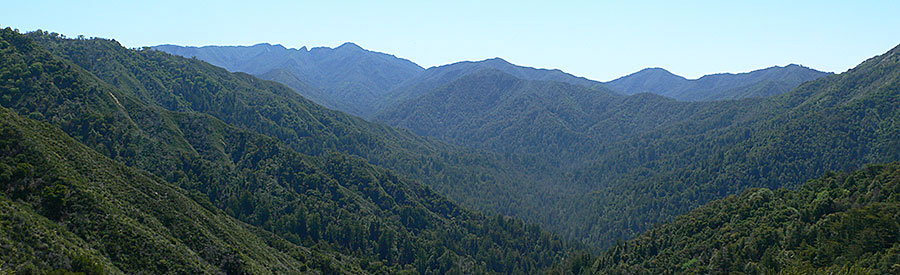
Since 1892, the Sierra Club has been the largest and most influential grassroots environmental organization in the United States. Ventana Chapter members are approximately 6000 of your friends and neighbors. Inspired by nature, we work together to protect our 127 miles of coastline, hundreds of thousands of acres of wild lands and our dwindling water supplies. (Ventana Wilderness from Bottchers Gap, Ventana Chapter file photo).
The Future of Desalination Lies With Small-Scale Household Systems
Large municipal desalination plants create more problems than they solve
April 9, 2024
by Julia Sklar
Illustrations by Peter and Maria Hoey
from Sierra: The Magazine of the Sierra Club
Large-scale desalination is an enticing dream in a warming world with a dwindling supply of drinking water. If we could simply remove the salt, Earth's 352 quintillion gallons of ocean water would become a potable pour.
The dream isn't new. The first patent for a desalination system was issued in England in the 1600s, and the first municipal plants opened in the Caribbean and the Middle East in the early 20th century. But almost 100 years later, we still don't have a robust global desalination network. In the United States, plants are clustered in Florida and California, despite the growing need elsewhere. In regions like Tampa Bay and San Diego—site of the largest desalination plant in the country—desalinated water still accounts for only 10 percent of drinking water.
How It Works
Scientifically, it is quite simple to create clean drinking water from salt water. The most common method is reverse osmosis, which puts water under immense pressure to filter out salt, minerals, and other unsafe bits. The large amount of energy required to create that pressure is a major reason we haven't seen a desalination-plant building spree. Energy accounts for as much as 40 percent of the hefty cost of the process.
How It Doesn't Work
If desalination plants are powered by fossil fuels, there is also a planetary cost, exacerbating future droughts and creating a circular climate issue. The annual emissions from a large desalination plant can equal those of more than 50,000 cars during the same period.
Even a desalination plant powered by renewable energy faces the second hurdle: brine. The leftovers from desalination are concentrated salts mixed with chlorine and copper. This saline sludge is dumped back into the ocean, which increases ocean acidification and can be deadly for marine life.
[Illustration shows a house with a small desalination system on the roof.]
How It Could Work
The National Renewable Energy Laboratory proposes harnessing the power of the salty waves themselves as a net-zero way of pressurizing municipal desalination plants.
Another option might be off-grid, household desalination systems using low-cost materials. Researchers at MIT and Shanghai Jiao Tong University have designed one small enough to sit on a rooftop but efficient enough to make about a gallon of drinking water per hour. Instead of reverse osmosis, the system relies on distillation: Solar heat (captured by blackened glass panels, not solar cells) evaporates water, leaving the salt behind; the recycled heat then condenses the vapor back into a potable liquid. Instead of electrified pumps to bring the salt water in, the tool relies on the power of gravity to passively draw salt water through several filters. The byproduct is still salty brine but without toxic chemicals. Researchers are working on getting rid of the liquid entirely, leaving only salt crystals—the same kind one might use to season dinner.
The Upshot
Desalination—without excessive energy costs or toxic byproducts—is at present probably best achieved by scaling up passive, inexpensive systems designed for individual coastal households. Bonus: Such systems could be cheaper for a family to run and maintain than paying their usual municipal water bill.
Source article at Sierra Magazine
Note: Ventana Chapter is currently opposing a massive, unneeded desalination plant in the City of Marina in Monterey County. In addition to the serious threats to the marine environment and local water supplies, there are consequential environmental justice issues. The community of Marina has a large percentage of low income and marginalized populations. The negative impacts of a complex desalination plant at this site is an egregious example of poor land use and a violation of environmental justice. The Sierra Club has long held a position on environmental justice that when environmentally damaging projects are proposed, they should not be systematically placed only in communities of color and the disadvantaged. These very communities in the City of Marina will be those most deprived of free and easy access to the beach for appreciation of the coastal views, walking and other recreational opportunities.
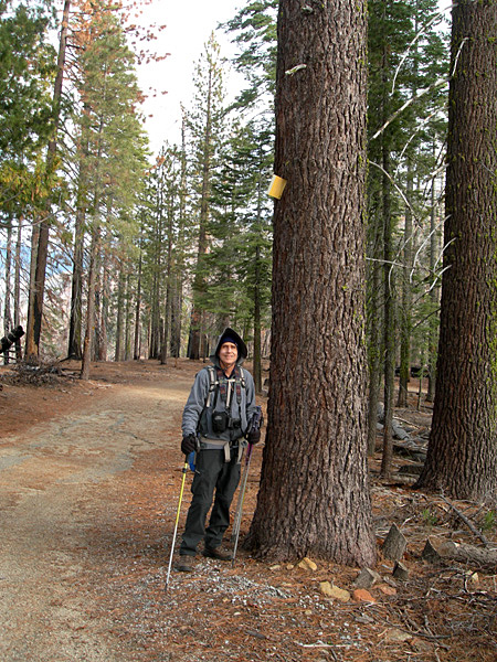 Richard looking up at a ski trail marker. Richard looking up at a ski trail marker.
Mariposa Grove
December 26, 2023
by Debbie Bulger
photos by Debbie Bulger & Richard Stover
This was planned as a ski/snowshoe trip. Mother Nature had other plans.
We hadn’t been to Mariposa Grove in Yosemite National Park since the park restored the site where giant sequoias tower over visitors. The Grove was closed to visitors from 2015 to 2018 while the $40M project was underway. The result is a markedly more peaceful and inspiring experience for visitors and a major restoration of sequoia and wetland habitats.
Parking was relocated to two miles from the grove with shuttle service in summer and a trail to the grove. Commercial services were eliminated, paved roads replaced by accessible trails and hydrology restored. For a 4 minute video about the changes visit, https://www.nps.gov/yose/planyourvisit/mariposagrove.htm
Since we were visiting in the winter, there was no shuttle. The welcoming center has wonderful displays and interpretive panels including a statue of a fisher, an elusive member of the weasel family. In all my years of backcountry travel I have seen only two.
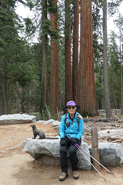 Debbie sitting next to Fisher statue. Sequoias in background. Debbie sitting next to Fisher statue. Sequoias in background.
|
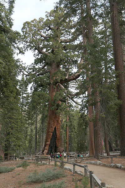 The Grizzly Giant The Grizzly Giant
|
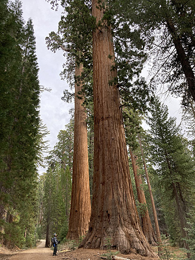
Perhaps the most massive tree in the grove is the Grizzly Giant, estimated at over 2700 years old.
Just beyond the Grizzly Giant is the Tunnel Tree carved in 1895 for stagecoaches. We know better now. |
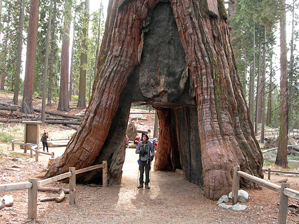 Richard at the Tunnel Tree. Richard at the Tunnel Tree.
|
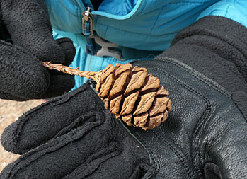 Sequoia cones contain about 200 seeds.. Sequoia cones contain about 200 seeds..
Beyond these two titans visitors thin out considerably as the distance to the parking lot from these trees is three miles making for a 6-mile round trip in winter. We continued on to Wawona Point and sights beyond making for an 11.5-mile hike with about 1600 feet of gain on well-developed trails.
The enormous sequoia trees spring like their cousin redwoods from a small seed. Sequoia cones are larger than redwood cones and contain about 200 seeds.
Even for folks like us living near redwood trees, these trees are awesome. In their presence one realizes just how small humans are. |
 Richard gazing up at a Sequoia. Richard gazing up at a Sequoia.
|
 The route is replete with old roads and new cow paths. The route is replete with old roads and new cow paths.
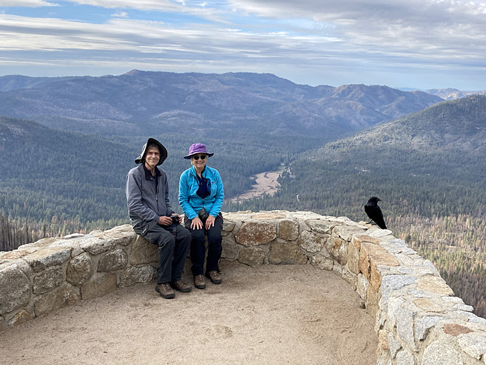
We were greeted by a Raven when we reached Wawona Point.
This one had little fear of people and posed for a photo alongside us.
|
 From Wawona Point we could almost see the cabin where we were staying. From Wawona Point we could almost see the cabin where we were staying.
|
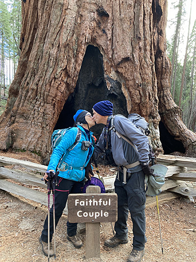
The highlight of our hike was an up close view of a White-headed woodpecker dining on insects on a fused double-trunked tree called the Faithful Couple.
A moment to remember. |
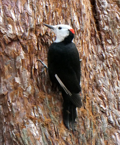 A male white-headed woodpecker. A male white-headed woodpecker.
|
|
President Biden Designates New National Monument Near Grand Canyon
Baaj Nwaavjo I’tah Kukveni—Ancestral Footprints of the Grand Canyon National Monument will honor tribal heritage and protect the area from uranium mining
August 2023
by Lindsey Botts
from Sierra: The Magazine of the Sierra Club
 Photo by Nicole Segnini/NPS Photo by Nicole Segnini/NPS
Native American nations in the Southwest rejoiced on Tuesday when President Biden created a new national monument that protects federal lands surrounding Grand Canyon National Park. The new Baaj Nwaavjo I’tah Kukveni—Ancestral Footprints of the Grand Canyon National Monument will protect some 917,000 acres of federal land from new mining claims and will also bring added protections to thousands of Native American cultural sites in the area.
"Establishing the Baaj Nwaavjo I’tah Kukveni—Ancestral Footprints of the Grand Canyon National Monument honors our solemn promise to tribal nations to respect sovereignty, preserves America’s iconic landscapes for future generations, and advances my commitment to protect and conserve at least 30 percent of our nation’s land and waters by 2030,” Biden said in a statement Monday.
The presidential designation is the culmination of a decades-long push to create a national monument to preserve tribal heritage and protect vast swaths of the Colorado River watershed from uranium mining. While the gorge of the Grand Canyon and the mainstem of the Colorado River are protected by the national park, much of the surrounding lands have been open to commercial logging and uranium extraction.
Like Bears Ears National Monument in Utah, the new national monument will be comanaged with Native American tribes. Tribal members will be able to exercise their treaty rights, such as hunting, gathering, and practicing religious ceremonies. A dozen Native nations make up the Grand Canyon Tribal Coalition, which earlier this year called on President Biden to permanently protect the watershed around the Colorado River, a water source for nearly 40 million people. The coalition includes the Havasupai, Hopi and Navajo (or Dine), all of whom, along with other nations, consider the area where the monument is located part of their traditional homelands. The name of the monument is a combination of two Indigenous phrases: Baaj Nwaavjo, which means “where tribes roam” in Havasupai, and I’tah Kukveni, which means “our ancestral footprints” in Hopi.
"We have lived in and around the Grand Canyon since time immemorial. Our ancestors were once spread far and wide throughout the region," Havasupai Tribe vice chair Edmond Tilousi said in a statement earlier this year as the campaign for the national monument gained momentum. "Our home is still in the Grand Canyon.... The canyon is a part of each and every Havasupai person. It is our home, it is our land and our water source and our very being."
Read full article here.
Climate Change Impacts and Energy Challenges on the Central Coast of California - Let’s Take Action Now!
August, 2023
The central coast of California, a jewel of diverse landscapes, extensive biodiversity, and robust agriculture, is in the grip of the twin challenges presented by climate change and energy production. This region is experiencing a convergence of climate-related impacts and an urgent need to shift our rethink its energy infrastructure.
As a result of these impacts, the Chapter is interested in forming a Monterey County Climate and Energy change committee and is reaching out to members who wish to participate. There is some urgency that our local Sierra Club study changes in the areas we know well and look for solutions we can share with policy makers and a larger audience.
Among the most visible impacts of climate change are the increased frequency and severity of wildfires. Fueled by drier conditions, higher temperatures, and shifting precipitation patterns, wildfires are becoming an all-too-familiar threat. The impact of these blazes extends beyond environmental damage, causing smoky skies, hazardous air quality, and severe public health risks.
Simultaneously, water shortages and recurrent droughts pose an escalating challenge. Monterey County has several important rivers at overdraft levels. Combined with unpredictable rainfall, this threatens the region's water supply, impacting agriculture — a backbone of the state's economy. Considering California's position as one of the nation's leading agricultural producer, these implications reverberate far beyond the state borders.
The rise in sea levels, resulting from melting polar ice and warming oceans due to climate change, is another serious concern. Increased coastal erosion and flooding pose a risk to local infrastructure and agriculture production and could impact the flourishing tourism industry that sustains many coastal communities.
The region's biodiversity, too, is facing a precarious future. Changing temperatures and precipitation patterns are causing shifts in habitats and ecosystems. The effects range from altering bird migration patterns to endangering the health of marine life along the coast.
And, of course, the diverse people who live in our region are facing these impacts now – just look at the devastating flooding of Pajaro which caused extensive damage to homes and businesses and long evacuations and loss of belongings and jobs for the many farmworker families living there. Climate impacts are having a huge impact on low-income communities, who have the least resources to respond and recover.
However, amid these challenges lies many an opportunity — a transformation to clean energy, shifting our transportation system away from fossil fuels, building electrification, investing in our natural and working lands and less waste, all of which are well under way in California. The urgency of the climate crisis necessitates a swift transition away from fossil fuels towards renewable energy sources, a move that can alleviate some of the stress on the environment and present a sustainable future.
The central coast of California is uniquely positioned to lead this energy transformation. The region boasts abundant sunshine, making solar power a viable option and prevailing winds can be harnessed for wind energy. Advancements in battery technology and energy storage also allow for a more reliable supply of renewable energy, addressing concerns about the intermittent nature of wind and solar power.
Moreover, the transition to renewable energy is not just about power production — it's about consumption as well. Energy-efficient buildings, electric vehicles, and smart-grid technology can significantly reduce the demand for energy, contributing to a sustainable and resilient energy future for the region.
Despite these challenges, Monterey County is a beacon of climate action and innovation. Community resilience is at the forefront, with local residents, scientists, and policymakers implementing water conservation measures, fire management strategies, and investing in renewable energy and green infrastructure.
In conclusion, the challenges posed by climate change and energy production on the central coast of California are significant and multifaceted. Yet, they are not insurmountable. Monterey County has been working on a Climate Action and Adaptation Plan (for unincorporated areas) and many cities in the county have adopted or are working on local climate plans.
The timing is critical because substantial federal funding for clean energy investments is becoming available through the Inflation Reduction Act (IRA) and Infrastructure Investment and Jobs Act (IIJA) to help cities, businesses and residents afford clean energy, heat pumps and rooftop solar, EVs, chargers and more. We have the opportunity to advocate for through strategic planning, investment in sustainable practices, and building resilient communities that will not only combat these impacts but also lay the groundwork for a sustainable, energy-efficient and an equitable future. The potential for transformation is immense, and the time to act is now.
If you are interested in getting involved with this new Monterey County Climate and Energy committee, please contact Kathy Dervin at:
Please RSVP or contact Kathy Dervin
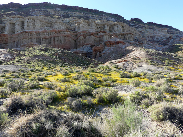
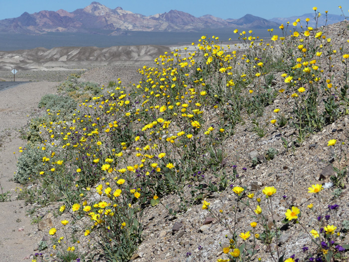
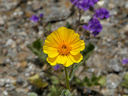
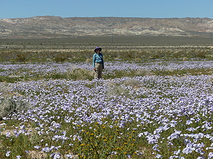
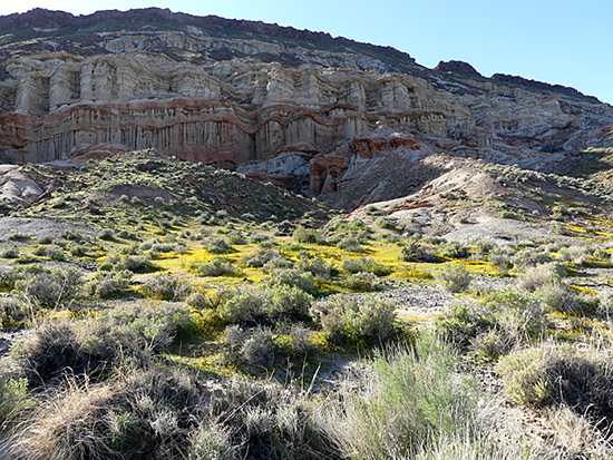 Goldfields at Red Rock Canyon State Park Goldfields at Red Rock Canyon State Park
It’s wildflower season after unusually heavy rains in California. Here are some stunning photos of flowers now blooming in the Mojave Desert by Richard Stover courtesy of Debbie Bulger. |
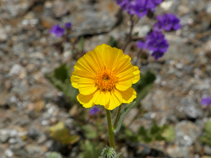
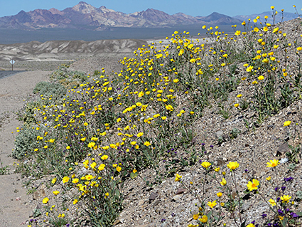 Desert Sunflowers Desert Sunflowers
|
 Desert Sunflower Desert Sunflower
|
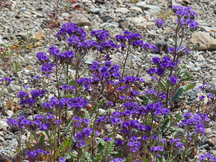
 Notch-leaved Phacelia Notch-leaved Phacelia
|
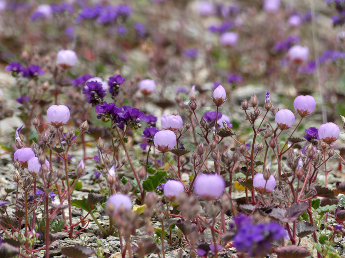
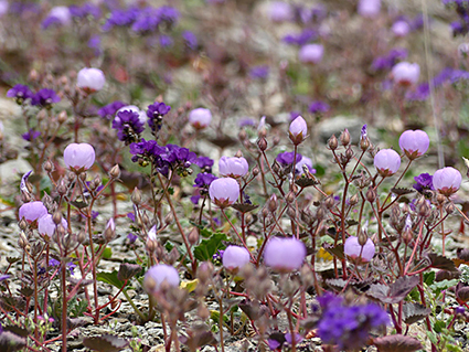 Desert Five-Spot and Notch-leaved Phacelia Desert Five-Spot and Notch-leaved Phacelia
|
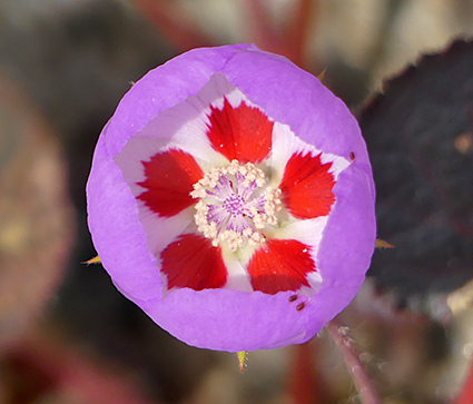 Desert Five-Spot Desert Five-Spot
|
 Broad-flowered Gilia Broad-flowered Gilia
|
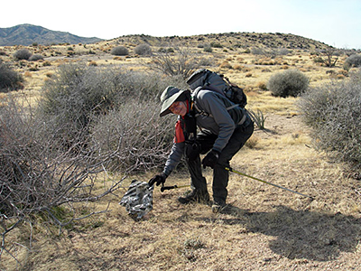
 We were getting closer to Barber Peak (on left) We were getting closer to Barber Peak (on left)
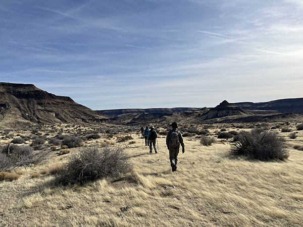
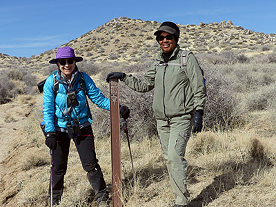
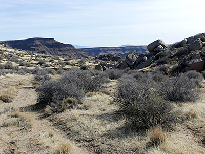
Mid Hills to Hole-in-the-Wall
February 16, 2023
by Debbie Bulger
This classic hike in the Mojave National Preserve requires a car shuttle. Five of us, Richard, Debbie, Med, Carmelita, and Jackie, walked from the Mid Hills Campground after spending a cold, cold night (28 degrees!). We were on the trail for about six hours hiking the eight miles to Hole-in-the-Wall Campground.
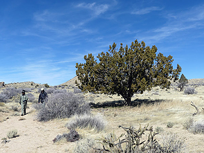
Before the Hackberry Fire of 2005, the route descended through a high-country pinyon pine/juniper forest. Today the land is a long way from healing although most of the skeletons of the charred trees have decomposed. Grazing is slowing up recovery since the cows are chomping much of the new growth.
There was a bit of uphill at the start of the hike.
There is still much to savor about this trek. We were a bit early for wildflowers, but could see numerous emerging desert mallow which I understand blanket the hills in the spring. Since the paved Black Canyon Road was closed due to a washout, we used the 4WD Wild Horse Canyon road for the car shuttle which thankfully delayed our start until it warmed up a bit.
The trail starts off well defined and is marked by fiberglass posts, however, many are missing. Bring your map and compass or GPS. Additionally the route is criss-crossed by numerous cow paths and old dirt roads which can confuse the hiker. However, if you have even basic skill with map and compass, it is difficult to get lost. The route is generally south. To the east and west are roads, so if you think you might never see your family again, just head east or west, and you will hit a real road.
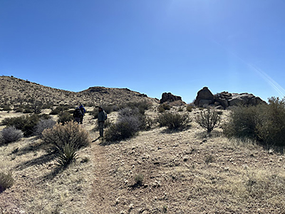
Along the way there are a few forest remnants and expansive views: To the east the volcanic mesa Table Mountain; to the south the interesting formations of Barber Peak. In all we dropped over 2000 feet and climbed 650 feet over rolling hills.
Approaching Hole-in-the-Wall we bypassed the narrows via a good trail on the west side of Barber Peak. As we dropped the last 400 feet through an unburned cactus garden, we could see our vehicle below.
 There was a bit of uphill at the start of the hike. There was a bit of uphill at the start of the hike.
|
 Along the way there are only a few trees that escaped the fire or have established since. Along the way there are only a few trees that escaped the fire or have established since.
|
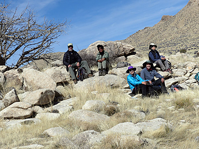 The five of us relaxing at lunch. The five of us relaxing at lunch.
|
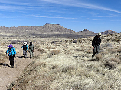 Table Mountain to the east. We had originally planned to climb Table, but the approach road was washed out. Table Mountain to the east. We had originally planned to climb Table, but the approach road was washed out.
|
 Debbie and Carmelita find a trail marker after not seeing one for several miles. Debbie and Carmelita find a trail marker after not seeing one for several miles.
|
 The route is replete with old roads and new cow paths. The route is replete with old roads and new cow paths.
|
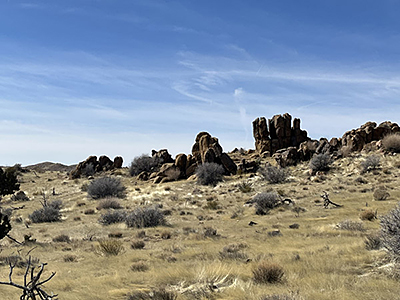 There were many interesting rock formations along the way. There were many interesting rock formations along the way.
|
 How many balloons are there in the wilderness? How many balloons are there in the wilderness?
|
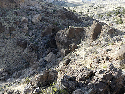 Looking down on the Narrows from the trail. Looking down on the Narrows from the trail.
|
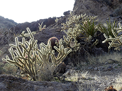 This beautiful cactus garden is on the well-defined trail about a half mile from our shuttle car. This beautiful cactus garden is on the well-defined trail about a half mile from our shuttle car.
|
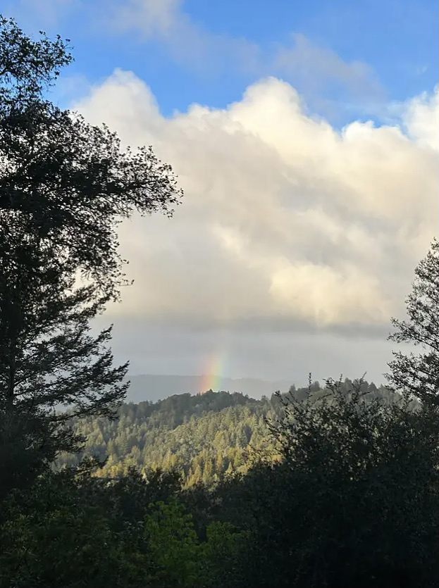
Recent rains brought a rainbow over the hills in Boulder Creek.
(Photo by Ethan Quaranta)
Introducing the New Executive Director of the National Sierra Club, Ben Jealous
December 2022
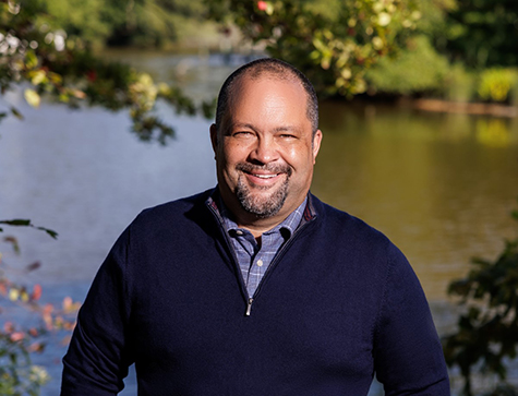 Photo by Christopher Jason Studios. Photo by Christopher Jason Studios.
The Board of Directors of the Sierra Club has voted unanimously in support of Ben Jealous, an experienced civil rights leader, community organizer, and coalition builder to be our new Executive Director. Ben’s passion for the outdoors and commitment to fighting for the environment, and his work leading People for the American Way and the National Association for the Advancement of Colored People (NAACP) – two of the nation’s most influential groups pursuing equity and justice and protecting democracy – makes him uniquely qualified to lead the Sierra Club at these intersections as our journey continues to create a healthy and sustainable planet for all.
From early in Ben’s life, he’s spent his time in nature and communities devoted to activism, from growing up in Pacific Grove, a neighborhood of oceanographers in California to summers spent with his grandparents during the civil rights movement in West Baltimore. The first protest Ben organized at school was against timber clear cutting. He worked as a journalist exposing “cancer clusters” in rural parts of Mississippi and was the youngest person to serve as president and CEO of the NAACP, which launched its climate justice program under his leadership.
Ben is now joining the most influential grassroots environmental organization at a critical juncture. Ben’s history and the Sierra Club’s role in the movement are coming together at a time that calls for bold, leadership to make sure there are never environmental sacrifice zones or disposable people living in them.
When Ben takes over his role with the Sierra Club on January 23, 2023, he will be the first person of color to lead the Sierra Club in its 130-year-old existence. This speaks to the meaningful moment we are in now, that now more than ever, we must work with communities who have been historically marginalized if we are to truly deliver on our mission to protect the planet for everyone. (Excerpted from an article by President of the Sierra Club Ramón Cruz).
Ventana Chapter Opposes Cal Am Proposed Desalination Plant in Marina Coastal Dunes at the California Coastal Commission
October 2022
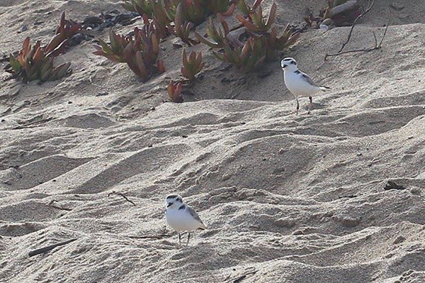 Threatened western snowy plovers in the Marina dunes. (Ventana Chapter file photo). Threatened western snowy plovers in the Marina dunes. (Ventana Chapter file photo).
On November 17 the California Coastal Commission (CCC) will meet in Salinas and on Zoom to hold a hearing on the proposed desalination plan plant proposed by Cal American Water. Cal Am, a private company with shareholders is the primary water purveyor for the Monterey Peninsula communities of Carmel, Pacific Grove, Seaside, Del Rey Oaks, Sand City, Carmel Valley, Carmel Highlands and Pebble Beach.
In early October, Cal Am released a description of a “phased approach” for the new desal plant which at first calls for building a 4.8 million-gallon-per-day facility on the soon to be shuttered Cemex plant in the coastal dunes in the City of Marina instead of any earlier proposal for a 6.4 million-gallon-per–day facility.
The signed Cemex Settlement agreement will now return those beaches and important sensitive habitats to the people for use as public access, low impact recreation and environmental protection. This was finally going to be a place where the residents of Marina and the Ord communities could go without expense to relax and enjoy the open spaces, coastal vistas within walking distance.
The negative impacts of a complex desalination plant at this site is an egregious example of poor land use and a violation of environmental justice. The Sierra Club has long held a position on environmental justice that when environmentally damaging projects are proposed, they should not be systematically placed only in communities of color and disadvantaged communities. All must share the pain associated with these projects.
For too long our society has engaged in systemic racial prejudice that manifests itself in many ways, one of which is to place these unwanted facilities in disadvantaged communities. This has the effect of sparing the financially well off, mostly white communities, from having to bear the effects of these projects. The City of Marina which has had to bear the brunt of almost all of these projects that benefit the Monterey Peninsula- a landfill, a wastewater treatment facility, a regional composting facility, an anaerobic digester facility and a sand mining operation that provided sand, gravel and cement for regional development. Marina also suffers from the adverse effects of leftover munitions and toxins from Fort Ord, a long established military installation that closed in 1994.
Marina formally adopted the Western Snowy Plover as their City shorebird because it symbolizes the environment and the need for protected places to be able to exist. If the Cal Am desalination project is allowed to be built, it will eliminate essential nesting habitat for the snowy plover and push the species one step closer to extinction. Public access will be impacted, recreational opportunity diminished and the beauty and potential views of serenity, open space and solitude will be lost for future generations.
In addition to threats to the federally threatened western snowy plover, many other rare and endangered coastal species that rely on the current Environmentally Sensitive Habitat Area (ESHA) will also be threatened. When the proposal was first officially proposed in 2020, the CCC staff report said the Project could result in up to about 35 acres of both temporary and permanent impacts to terrestrial ESHA during construction and operation, much of it to relatively rare coastal dune habitat.
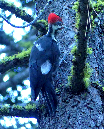 One of the two Piliated Woodpeckers we saw in Lassen NP One of the two Piliated Woodpeckers we saw in Lassen NP
Paulina Peak, 7984'
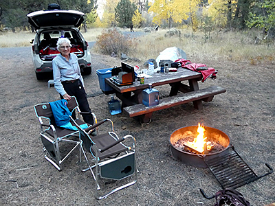
A Blast of a Birthday
October 2022
by Debbie Bulger
I chose to celebrate my 80th birthday with a blast from the past. That is, a volcanic excursion in Oregon and Northern California. Richard Stover and I began at Lassen National Park on our way to a celebration with family in Ashland, OR.
Imagine our elation as we watched not one, but two Piliated Woodpeckers drumming loudly at a pine near our Lassen NP campsite. Pieces of bark and feathers were flying. These large birds are a special treat to see and hear.
From our campground at Manzanita Lake we hiked to Crags Lake on the Chaos Crags Trail. After crossing a 10,000 – 15,000-year-old moraine we climbed two miles through a fir and pine forest past the Chaos Jumbles, an avalanche of rockfall from the adjacent steep Chaos Crags, eventually reaching the ridge above Crags Lake.
My guidebook from the 1980s predicted that this lake would be filled by rockfall by the “turn of the century.” Good call. No water—although I am told there is snowmelt there in the spring.
 Debbie descending from the ridge to a dry Crags Lake. Debbie descending from the ridge to a dry Crags Lake.
|
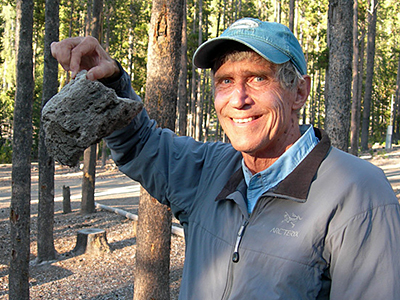 The rocks here are very light. The rocks here are very light.
|
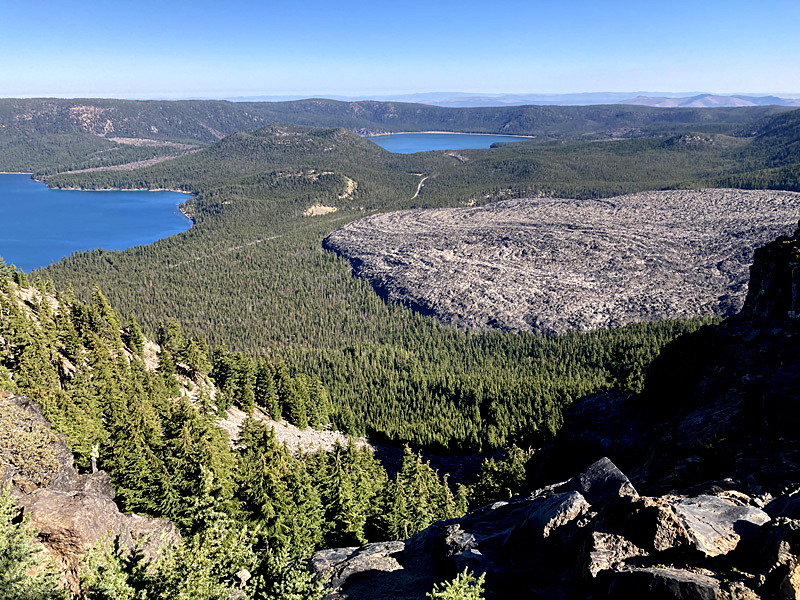 From the top of Paulina Peak one can see the Newberry Caldera containing Paulina Lake on the left and East Lake on the right. The flow lines of the Big Obsidian Flow are clearly visible from this viewpoint. The Central Pumice Cone is between the two lakes. From the top of Paulina Peak one can see the Newberry Caldera containing Paulina Lake on the left and East Lake on the right. The flow lines of the Big Obsidian Flow are clearly visible from this viewpoint. The Central Pumice Cone is between the two lakes.
After the family gathering in Ashland, our next stop on the volcanic tour was the Newberry National Volcanic Monument. This extraordinary place is a 6-mile-wide caldera filled with not one, but two crater lakes. Originally a single lake, East Lake and Paulina Lake were split by lava flows, one of which is the Big Obsidian Flow.
This square mile of volcanic glass poured out of the earth only 1300 years ago. It was an amazing short hike. Tourists are advised not to wear sandals, and dogs are not allowed on the trail because the sharp obsidian can cut feet. Informative signs along the way explain how and when the eruption occurred and how Native Americans used this valuable resource.
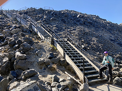 Stairs heading up Big Obsidian Flow Stairs heading up Big Obsidian Flow
|
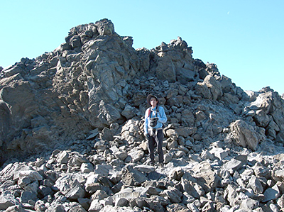 Richard walking among the chunks of obsidian and pumice. Richard walking among the chunks of obsidian and pumice.
|
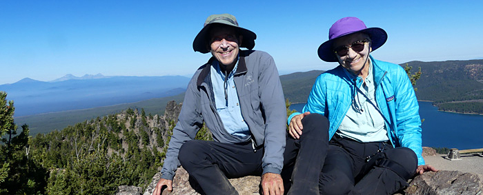 On the summit of Paulina Peak. Mt. Bachelor and South Sister on the left horizon. On the summit of Paulina Peak. Mt. Bachelor and South Sister on the left horizon.
We just had to climb Paulina Peak the next day for a birds eye view of the Big Obsidian Flow and glimpses of Mt. Bachelor and South Sister to the north. There is a well-graded 3-mile trail to the summit and a road for those who prefer to drive or bike.
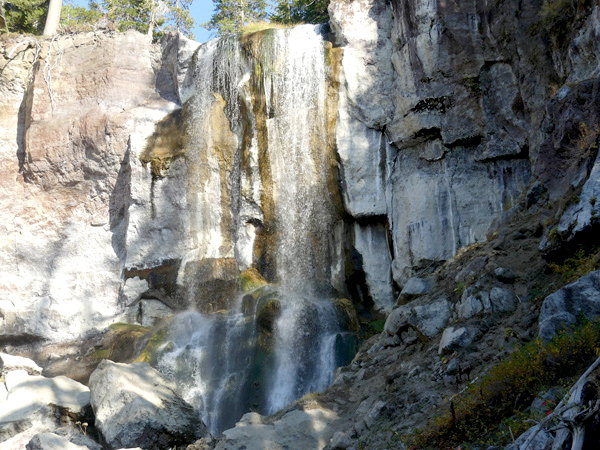 Paulina Falls. Paulina Falls.
Unfortunately mid-October is a bit late for camping at this National Monument. The rangers were busy closing up the campgrounds and covering all the signs in black plastic. We camped nearby in the national forest. Additionally, there was smoke starting to drift eastward from fires near Bend. After a short visit to Paulina Falls (reduced flow in the fall, but still wonderful) we returned the way we came on roads less travelled.
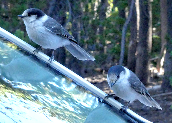 These bold Grey Jays swarmed our car to clean our windshield. These bold Grey Jays swarmed our car to clean our windshield.
As we briefly stopped on our way through the maze of mostly dirt/gravel roads in the surrounding national forest, Gray Jays descended on our car. They have learned that windshields are a great place to find lunch.
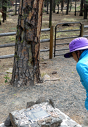
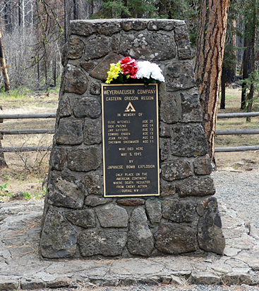 Mitchell Monument near Bly, OR Mitchell Monument near Bly, OR
|
 This Ponderosa Pine bears shrapnel scars from the explosion This Ponderosa Pine bears shrapnel scars from the explosion
|
Our meandering way home took us to Summer Lake Hot Springs and later the Mitchell Monument near Bly where six Americans were killed by a Japanese explosive device in May of 1945. Elsie Mitchell a Sunday School teacher and five of her pupils ages 11-14 were on a picnic when they gathered around a found object which exploded. It was a balloon-carried weapon borne by the jet stream at 30,000-40,000 feet and which had been designed by the Japanese to ignite forest fires in the Pacific Northwest in order to divert Americans from the war effort. A nearby tree still bears shrapnel scars.
Mrs. Mitchell had been pregnant with her first child. Her husband, a preacher, was parking the car when the bomb went off. In the 1980s, Yuzuru John Takeshita, a Japanese American who had been imprisoned at Tule Lake during the war learned about the incident on a visit to Japan from a woman who had been removed from high school during the war to work making the balloon bombs (called fugos) from paper and persimmon paste. Subsequent contact between the Japanese women and Oregon residents resulted in a rededication of the monument, gifted cherry trees for the site, and 1000 paper cranes to aid in healing.
A lesson in humanity for this writer born during the Second World War.
 A beautiful campsite near Summer Lake Hot Springs. A beautiful campsite near Summer Lake Hot Springs.
|
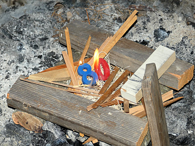 Candles make a great campfire starter. Candles make a great campfire starter.
|
Ventana Chapter Signs On to Letter to US Forest Service Requesting Extension of Comment Period for Proposed Forest Clearing Project
September 2022
The Forest Service has proposed a 235,000-acre logging and chaparral removal project in the Los Padres National Forest. This new proposal would allow the use of heavy equipment to cut trees up to two feet in diameter across 48,000 acres and trees of any size and age across an additional 186,000 acres. It would also allow mastication and activities to remove native shrubs across the entire project area.
The agency has stated they plan to prepare a single environmental assessment (EA) for the entire project. This would not involve site specific analyses for activities that would take place across the 368-square-mile project area in Monterey, San Luis Obispo and Santa Barbara Counties, nor would it involve public notice that activities are going to occur in this area once this single EA is approved. This letter requests that the USFS:
The U.S. Forest Service must prepare an EIS for the ERP before moving forward. The EIS should analyze several alternatives, including a significantly scaled-back version of the ERP that avoids sensitive and protected areas such as IRAs, proposed and potential Wilderness, critical biological zones, special interest management areas, research natural areas, and designated critical habitat for threatened and endangered species. In addition, the EIS should evaluate a much more strategically-targeted proposal that focuses on vegetation treatments adjacent to structures along with partnerships with local jurisdictions to encourage and promote home hardening, defensible space around homes, improved evacuation routes, and human-caused ignition reduction on private and public lands.
These actions will ensure that the public and local experts have adequate time to weigh in with concerns and relevant information.
Ventana Chapter, along with other Sierra Club Chapters and allies has signed on to the full letter here.
Goddard Canyon
June 28 - July 5, 2022
By Debbie Bulger
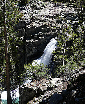
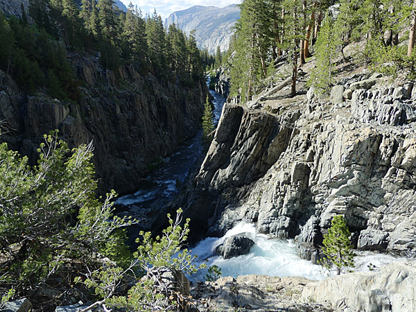 Scenic and biologically diverse, Work Memorial Park in The sheer walls of Goddard Canyon drop down to the South Fork of the San Joaquin River. (photo Richard Stover). Scenic and biologically diverse, Work Memorial Park in The sheer walls of Goddard Canyon drop down to the South Fork of the San Joaquin River. (photo Richard Stover).
Goddard Canyon is located between the John Muir Trail (JMT) and Martha Lake in Kings Canyon National Park. Its sculptor, the South Fork of the San Joaquin River, has carved a deep gorge with sheer walls dropping 50 feet to the river in some places.
From the Martha Lake outlet it flows north to the JMT then west for almost 50 miles growing in volume from tributaries until it reaches Florence Lake. Beyond that it continues to the Central Valley where it intermittently runs dry due to overzealous diversions until it finally joins the Sacramento River emptying into Suisun Bay and ultimately the Pacific Ocean.
Richard Stover and I were originally bound for Peter Peak where we planned to scatter my brother Peter’s ashes. The river gods had other plans.
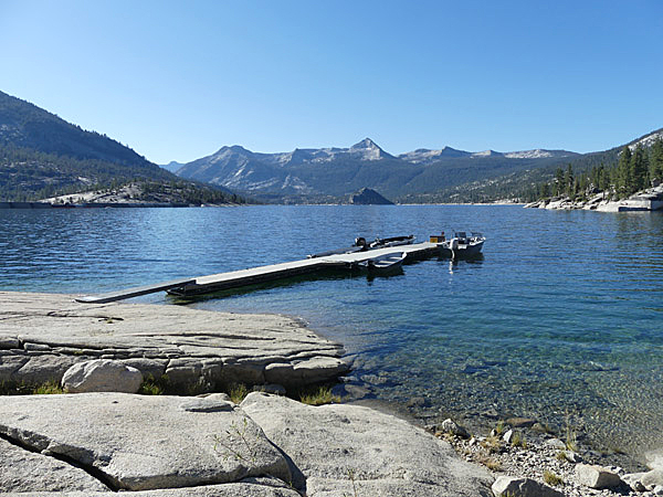 Florence Lake Ferry landing with pointed Mt. Shinn on center horizon across the lake. (photo Richard Stover). Florence Lake Ferry landing with pointed Mt. Shinn on center horizon across the lake. (photo Richard Stover).
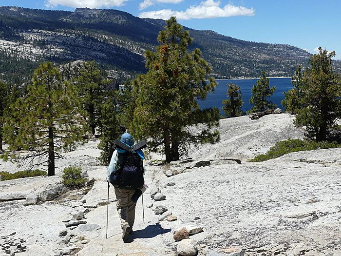
Having spent the night in the back of our car in the backpackers parking lot, we took the 9:30 a.m. ferry across Florence Lake. Our boat captain, Estella, was the source of good information about the lake, local resources, and the Muir Trail Ranch where she had previously worked.
The road to Florence Lake is much deteriorated partly due to heavy equipment use during the Creek Fire in 2020. Thankfully, the area where we were headed had seen no recent fires.
It’s about 11.5 miles from the ferry landing to the junction of the Goddard Canyon Trail. Along the way we met many Pacific Crest Trail and John Muir Trail hikers. These hikers (mostly young) all seemed to wear electronic tracking devices which let the folks at home know their whereabouts. Additionally many were constantly checking their cell phones on which were digital maps of the trail complete with GPS locators pointing to their location. Fortunately for them, the Muir Trail Ranch where they resupply now has electronic charging outlets!
Other backpackers became scarce after Richard and I turned south on the Goddard Canyon Trail. Indeed over the more than three days we spent in Goddard, we saw only three other parties. Visitors are so few that at least this year flowers were growing in the trail itself.
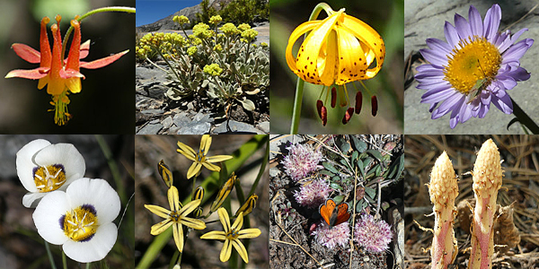 Click Photo for larger image. Click Photo for larger image.
From top left: Crimson Columbine, Hoary Buckwheat, Leopard Lily, Wandering Lily, Mariposa Lily, Pretty Face Brodia, Pussy Paws, Fringed Pinesap
(photos Richard Stover).
Did I say “flowers?” I meant to say FLOWERS!!!! This is a banner year due to late season rains. Flowers in every habitat. Flowers of every color, shape and size. Some I had never seen before. So many that I don’t have room for all their photos in this report. To name a few: Sierra wallflower, Crimson Columbine, Leopard lily, Alpine paintbrush, Stonecrop, Pretty Face brodia, Swamp onion, Wandering Daisy, Arnica, Pink Alumroot, Penstemon, Pussy Paws. Two plants I had never identified before were the Fringed Pinesap and the unobtrusive Green Raillardella which I had seen before, but not looked up.
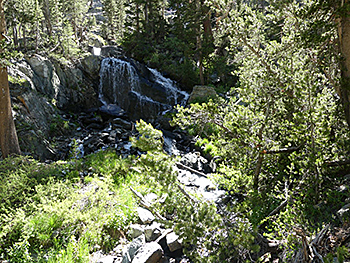
As we hiked up Goddard Canyon, our navigational skills were put to the test since we had decided not to bring our GPS on this trip to reduce weight. I counted drainages as we travelled up canyon as well as studied landforms. We were looking for North Goddard Creek which empties into the South Fork of the San Joaquin River where we wanted to cross the river to reach Peter Peak. There was one waterfall indicated on the map, but we observed several others, one almost as high as the marked one.
The high walls on either side of the canyon sported numerous cascades dropping hundreds of feet and spilling into the river below. |
Sometimes the water flowed onto the trail making hiking more interesting. |
 One of the side tributaries cascading down the canyon. (photo Richard Stover). One of the side tributaries cascading down the canyon. (photo Richard Stover).
|
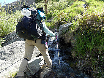 Water from a tributary flowing on the trail. (photo Richard Stover). Water from a tributary flowing on the trail. (photo Richard Stover).
|
This is the highest waterfall which was marked on the topo map. (photo Richard Stover).
|
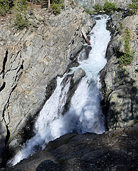
 This waterfall was just below our camp. (photo Richard Stover). This waterfall was just below our camp. (photo Richard Stover).
|
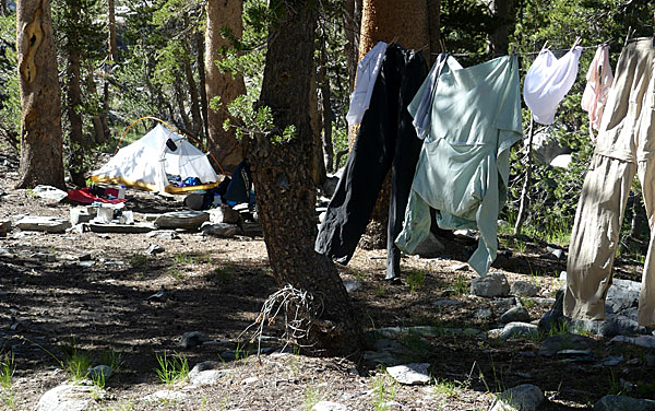 Our camp.
(photo Richard Stover). Our camp.
(photo Richard Stover).
Although the map shows the trail as next to the river, most of the time it is actually about 40-50 feet above the river on the rim of the gorge. Campsites are located in the few spots where the trail approaches the river.
We settled in to a perfect campsite very near where we hoped to cross. It was flat and expansive just above the second-highest waterfall and came complete with bear claw territory scratches on the lodgepole pine near where we set up our tent.
 On one of our layover days we hiked above the canyon looking for the remains of the Hell for Sure Trail.
(photo Richard Stover). On one of our layover days we hiked above the canyon looking for the remains of the Hell for Sure Trail.
(photo Richard Stover).
There was no question about our crossing the river near there. It was at peak flow and fast. When we rinsed out our dusty clothes, we had to hold on to them tightly so they wouldn’t break away from our grips and plummet over the falls. Crossing the South Folk was too dangerous for us. Peter Peak was out.
We spent the next two and a half days resting and scouting the area. We located the almost obscured intersection with the no-longer-existing Hell for Sure Trail which I hiked on my approach to Mount Goddard in 1984. It was hard to find in places even at that time. Today it is pretty much obliterated.
 Returning to Florence Lake.
(photo Richard Stover). Returning to Florence Lake.
(photo Richard Stover).
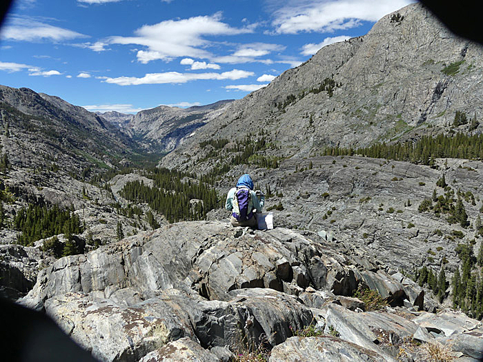
We hiked almost to Martha Lake for outstanding views both up and down canyon. There in a glorious spot in view of both Peter Peak and Mount Reinstein I released some of the ashes of my brother Peter who had died in November. A fitting resting spot for a fellow climber.
Over the next three days we hiked the 20 miles back to the ferry landing thoroughly renewed by our time in this beautiful canyon.
2022 Celebrates the 130th Anniversary of the Sierra Club
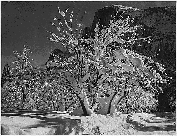 Trees with Snow on Branches, "Half Dome, Apple Orchard, Yosemite,” California by Ansel Adams, founder of Ventana Chapter Sierra Club in 1963. (Photo courtesy of the US National Archives and Records Administration). Trees with Snow on Branches, "Half Dome, Apple Orchard, Yosemite,” California by Ansel Adams, founder of Ventana Chapter Sierra Club in 1963. (Photo courtesy of the US National Archives and Records Administration).
1890s The Sierra Club is founded on May 28, 1892, with John Muir as its first president. It quickly mobilizes to defeat a proposal to reduce the boundaries of Yosemite National Park. The Sierra Club urges strengthening of public forest policy and supports the creation of new national parks, including Grand Canyon.
1900s The Sierra Club begins an organized outings program, with annual trips to the Sierra Nevada. President Theodore Roosevelt visits Yosemite National Park with John Muir and, two years later, the Sierra Club’s campaign to return management of Yosemite Valley to the federal government from the State of California succeeds.
1910s The National Park Service is created, with Stephen Mather, a Sierra Club member, as its first director. The California legislature passes a law to support construction of the John Muir Trail in the Sierra Nevada.
1920s Sequoia National Park is expanded, and the Sierra Club successfully opposes dam sites in the Kings River region. Aurelia Squire Harwood becomes the first woman to serve as the Sierra Club’s president.
1930s Sierra Club members introduce modern rock-climbing techniques to the US. Photographer Ansel Adams visits Washington, D.C., to lobby Congress and the president to preserve Kings Canyon. The 210-mile John Muir Trail is completed.
1940s Kings Canyon National Park is established. The Sierra Club opposes an attempt to repeal the Antiquities Act, which is used to establish national monuments. The Sierra Club successfully defeats proposed dams in Kings Canyon and Glacier National Parks. During World War II, many Club members use their backcountry skiing and mountaineering skills in the US Army’s 10th Mountain Division.
1950s Grand Teton National Park and Olympic National Park are enlarged at the Sierra Club’s urging. A long but ultimately successful campaign stops dam construction in Dinosaur National Monument. The Sierra Club organizes its first volunteer-service outings.
1960s The landmark Wilderness Act is passed by Congress after a long campaign by the Sierra Club and others, marking the first time that public lands (9.1 million acres) are permanently protected from development. The Sierra Club also mobilizes public opinion to stop two dams in the Grand Canyon. But the cost of victory was high: Decision-makers chose to power the flow of water to the Southwest by building a massive coal-fired power plant on Navajo land. For more than four decades, the plant exposed members of the Navajo Nation to unacceptably high levels of air pollution. According to the Clean Air Task force, the plan caused an estimated 16 premature deaths, 25 heart attacks, 300 asthma attacks, and 15 asthma emergency room visits every year it operated.
1970s The Sierra Club helps organize the first Earth Day. Efforts of the Sierra Club and others—including Black community organizers who fought against destructive “urban renewal” projects—lead to passage of the National Environmental Policy Act and the Water Pollution Control Act. The Sierra Club also joins a successful effort to strengthen the Clean Air Act and works to pass the Endangered American Wilderness Act, which protects 1.3 million acres.
1980s A decade-long Sierra Club campaign leads to passage of the Alaska National Interest Lands Conservation Act—the largest land and water protection legislation in history. It instantly doubles the size of the national park system and protects more than 157 million acres of public lands in Alaska. The Sierra Club helps defeat Reagan administration attacks on the Clean Air Act and other environmental laws. The Sierra Club forms a political committee and makes its first electoral endorsements.
1990s The Sierra Club leads a grassroots effort to reauthorize the Clean Air Act and successfully lobbies Congress to pass the California Desert Protection Act, which establishes 7.6 million acres of new desert wilderness and expands both Death Valley and Joshua Tree National Parks. The Sierra Student Coalition is organized. The Sierra Club forms an Environmental Justice program to address the disproportionate environmental burdens on low-income communities and communities of color.
2000s The Sierra Club defeats a plan to allow commercial logging in Giant Sequoia National Monument and stops the construction of 170 proposed new coal-fired power plants. The Sierra Club successfully advocates for the Omnibus Public Land Management Act—the largest public-lands conservation effort in 20 years.
2010s The Sierra Club works with President Obama to protect more than 4 million acres of public lands. The Sierra Club’s Beyond Coal campaign becomes the most successful environmental initiative in history and is complemented by the Ready For 100 campaign, which encourages more than 100 US municipalities to formally commit to transition to 100% clean, renewable energy for generating electricity.
Monarch Butterfly Numbers Are on the Rise Locally and in Mexico
June, 2022
Some good news this year is that various press outlets both nationally and locally are reporting an increase in Monarch butterflies in several locations. The Monterey Herald reported earlier this year that volunteer community scientists recorded about 14,000 butterflies at the Pacific Grove Monarch Butterfly Sanctuary in November 2021, according to Natalie Johnston, the volunteer and community science coordinator of the Pacific Grove Museum of Natural History. There were no recorded butterfly clusters in 2020 so this was quite a rebound.
On May 25 Associated Press reported a 35 percent increase in Monarch butterflies arriving this year in the protected areas in the forested mountaintops of Mexico. Their annual butterfly count does not count the number of butterflies but rather the number of acres they cover. Last year’s acreage was 5.2 acres and this year it was 7 acres.
Positive Steps Happening Now in the Arctic National Wildlife Refuge
June, 2022
Published by Clayton Daughenbaugh for the Sierra Club National Wilderness Committee
We've had a series of big developments in the campaign to protect the Arctic National Wildlife Refuge that are worth celebrating.
In the last two weeks, all oil companies that held leases within the boundary of the Refuge have withdrawn their lease agreements. Chevron and Hillcorps held leases through the Arctic Slope Regional Corporation (ASRC) and actually paid 10 million dollars to exit their arrangement. They acquired the leases on ASRC land from a historic deal that would have allowed them to develop them when drilling proceeded on the federal lands in the coastal plain. Keep in mind that the federal lease sale held in 2020 by the Trump administration only brought in 12 million dollars, meaning that these companies paid almost as much to get out as was generated in a lease sale. Then, just last week, 88 Energy withdrew their federal leases which they acquired during the Trump lease sale. 88 Energy was the only oil company to lease exploration rights in 2020, with the rest of the leases bought by either the State of Alaska or a small real estate speculator.
Why are oil companies leaving when oil is reaching historic high prices? We have brought a tremendous amount of pressure to bear. Over the last three years, this campaign has focused on corporate work aimed at cutting off essential finance and insurance to the industry in the refuge, while at the same time forcing the administration to publish a supplemental environmental impact statement via advocacy and smart, strategic litigation. In addition, we have also effectively advocated for revoking the leasing program in the halls of congress. We've sent a clear message that along with our partners; we will stop them on every axis.
Furthermore, we secured a new commitment from a major international insurance company to exclude underwriting or bonding for oil and gas companies drilling in the Arctic Refuge. Sompo joined 13 other companies in making this commitment, amplifying the pressure we are already putting on American insurers. This announcement came on the heels of a campaign arch of phone calls, emails, and an in person rally at the headquarters of Travelers insurance during their Annual General Meeting (AGM). We also directed the same pressure, minus the in person action, at The Hartford during their AGM. Each insurer we remove from the board means one less place for oil companies to turn to get required insurance. For the rest of this year, we'll continue to escalate with American insurers until we have taken all of their options away from oil developers. This should help influence any future lease sales and to remove opposition from a legislative or administrative solution.
This team has done a tremendous job both as a stand alone and in collaboration with our partners.
Chapter Support For Protection of Work Memorial Park in Del Rey Oaks
May, 2022
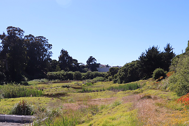 Scenic and biologically diverse, Work Memorial Park in Del Rey Oaks needs protection from planned construction in the nearby areas of the former Fort Ord, urban and airport runoff and the commercial use of Work Memorial Park for large truck traffic. Scenic and biologically diverse, Work Memorial Park in Del Rey Oaks needs protection from planned construction in the nearby areas of the former Fort Ord, urban and airport runoff and the commercial use of Work Memorial Park for large truck traffic.
(Ventana Chapter file photo).
Work Memorial Park is one of the three large parks in Del Rey Oaks and the location for significant federally recognized wetlands. Upstream, it is connected by the Arroyo Del Rey stream to the Frog Pond Preserve (part of Monterey Peninsula Regional Park District) and the “17 acres” wetland area just east of General Jim Moore Blvd. Downstream, Work Memorial Park waters flow into Laguna Grande Regional Park, Roberts Lake, and finally into the Monterey Bay National Marine Sanctuary. Work Memorial and the 17 acre wetland areas are important and sensitive habitats that represents two of the last natural drainages in the cities of Seaside, Del Rey Oaks, and Monterey.
Unfortunately, Work Memorial Park and the Arroyo Del Rey watershed are under many threats. The runoff from Hwy 68 and 218, the planned construction in the nearby areas of the former Fort Ord, the urban and airport runoff, and the commercial use of Work Memorial Park for large truck traffic are just a few.
Sustainable Del Rey Oaks (SDRO) contacted the Chapter and brought this to our attention. What was needed was a professionally conducted wetland delineation and habitat assessment to understand what habitats and species are present, the current health of these habitats, and what our paths forward may be to protect and restore these wetlands. These studies are woefully lacking in many areas of our County and yet, without them, it is difficult to bring the credibility and pressure needed to ensure that sensitive habitats are protected when development projects are proposed.
The Chapter retained The Biotic Resources Group, a local environmental assessment firm to conduct a study. The scope of work included a wetland delineation (federal standard) and habitat assessment of the study area (Work Memorial Park, Arroyo del Rey, and the 17-Acre Parcel). The habitat assessment tasks included mapping plant community types, identifying occurrences of invasive, non-native plant species, and documenting sensitive species and/or habitat.
The assessment has been completed and the overview states the Biotic Resource Group conducted a formal wetland evaluation and reported their findings in two complementary documents. The SDRO Arroyo Del Rey and Work Memorial Park Study Delineation of Jurisdictional Federal Waters (Delineation) follows the US Army Corp of Engineers format; whereas the SDRO Arroyo Del Rey and Work Memorial Study Baseline Report (Baseline) is more expansive, including descriptions of plant communities, threatened and invasive, and recommendations for habitat management. The 54.9 acres studied includes Work Memorial Park, the Arroyo Del Rey stream itself, the “17 Acres” parcel, and to a lesser degree, the Frog Pond Preserve. The study identified 10.162 acres of wetland habitat, as well as 9 different sensitive plant habitats. It also identified 21 non-native invasive plants.
Shuttered Cemex Site in Marina Now Under Negotiations for Future Use as Public Coastal Acreage
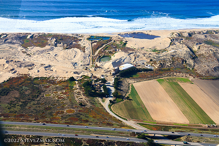 Current Cemex plant now in the process of being repurposed as public land. Current Cemex plant now in the process of being repurposed as public land.
By Kathy Biala
May, 2022
On Dec. 31, 2017 the CA Coastal Commission, along with the State Lands Commission and the City of Marina approved a settlement agreement with Cemex, that would end the last active sandmining operation on any U.S. shore. This agreement requires Cemex to sell the property, at a reduced purchase price, to a non-profit or governmental entity approved by the Commission for conservation, public access and low impact recreation in perpetuity. This was a historic moment.
Per the agreement, all sand extraction has ceased as of Dec. 31, 2020 and now the last sales of the remaining stockpiles of sand on the property will occur and the remaining staff will be transitioned out. The agreement requires a restoration plan be completed in three years from the cessation of the sandmining operations (by 2023).
However, this Cemex property remains a site of concern for the public, as the proposed CalAm slant well desalination project is planned on this very same property, with several large well head structures on the near foredunes and pipes traversing the property. A legal easement to do so was established by CalAm and Cemex several years ago.
The CA Coastal Commission has twice recommended denial of the CalAm project on environmental and environmental justice issues; CalAm withdrew their application the night before the second and final hearing on the project. The current reapplication has been deemed incomplete by the CCC, and further hearing on the project has been stalled as a result.
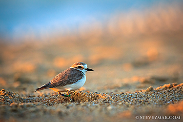 Protecting populations of threatened western snowy plovers at the Cemex site and along the Central Coast beaches are a priority for Ventana Chapter. Protecting populations of threatened western snowy plovers at the Cemex site and along the Central Coast beaches are a priority for Ventana Chapter.
The elements of the Cemex Settlement Agreement are not affected by the outcomes of the CalAm desalination project. The Coastal Commission staff report continued compliance with all aspects of the agreement; the land restoration plan is currently being reviewed by the CCC and other required agencies, and restoration activities will be overseen by the CCC. Full restoration will likely continue beyond 2023. Ventana Chapter has a mitigation fund of hundreds of thousands of dollars that could be used towards restoration.
The Cemex site is to be sold to public agencies and negotiations are now occurring. The coastal property site that is under the Settlement Agreement is approximately 100 acres and will soon become a publicly owned, protected natural environment for threatened and endangered species to thrive. This will also contribute to further beach access points to residents of Marina and tourists to experience and enjoy pristine coastline habitats.
U. S. Senate Committee Unveils Historic Outdoor Recreation Package
By Ian Brickey
May 3, 2022
Park Funding Measures Will Boost Community Health, Help Tackle Climate Change
WASHINGTON, D.C. -- Today, the Senate Energy and Natural Resources Committee began its mark-up of a major outdoor recreation legislative package, which includes the Outdoors for All Act. If passed, the Outdoors for All Act would permanently authorize the Outdoor Recreation Legacy Partnership (ORLP) program, which is the only program administered by the Department of the Interior to promote the development of equity-focused parks and green space projects in urban communities. The committee is expected to send the bill to the full House in the coming days.
Multiple studies show that nearby access to parks and green and natural spaces increases community health outcomes while boosting local economies and helping achieve the goal of protecting 30% of lands and waters by 2030 necessary to stop the most damaging effects of climate change.
In response, Jackie Ostfeld, director of Sierra Club’s Outdoors for All Campaign, released the following statement:
“Parks and green spaces make our communities more resilient. They offer clean air, provide shade to cool neighborhoods, and allow all people, regardless of age, race, or privilege, to make a direct connection with nature. As we face a national mental health crisis and the increasingly devastating effects of the climate crisis, the mental and physical health benefits of nature are more critical than ever. Passing the Outdoors for All Act will allow more communities across the country, especially in urban areas, to finally enjoy the benefits only these natural places can provide, while helping build up the green infrastructure we need to take on climate change.”
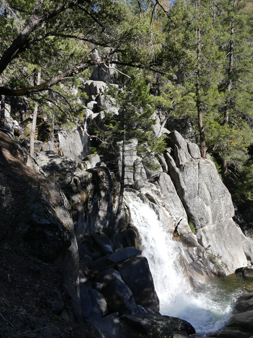 Lower Chilnualna Falls Photo by Richard Stover Lower Chilnualna Falls Photo by Richard Stover
Chilnualna Falls
By Debbie Bulger
February, 2022
One of my favorite Wawona-area hikes in Yosemite National Park is Chilnualna Falls. During a rest day between two snow tours, Richard Stover and I visited the lower falls. The longer hike to the upper falls is a full day affair which we have done in the past.
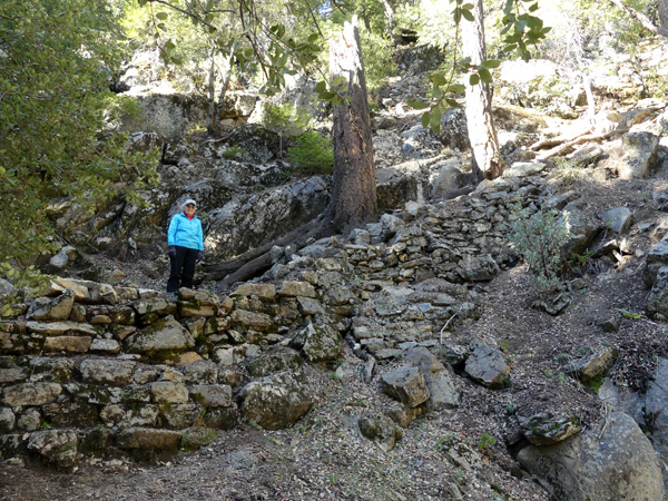 The lower part of the trail has a lot of rockwork. Photo by Richard Stover The lower part of the trail has a lot of rockwork. Photo by Richard Stover
The highlight for me is the careful rockwork including several “staircases in the sky” on the lower portion of the trail.
 Mountain Quail have straight topknots instead of the comma-shaped ones of our local quail.. Mountain Quail have straight topknots instead of the comma-shaped ones of our local quail..
Photo by Richard Stover
A bonus on our way back was a covey of Mountain Quail with their straight topknots.
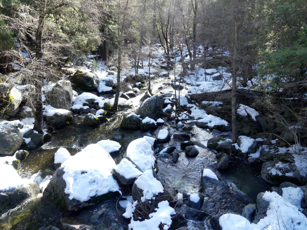 The south fork of Chilnualna Creek in winter. Photo by Richard Stover The south fork of Chilnualna Creek in winter. Photo by Richard Stover
The snow on the South Fork of Chilnualna Creek enhanced our festive mood.
We had fun practicing pronouncing the name of this lovely creek with its falls.
What IS 30 X 30 and Why?
By Vicky Hoover and Anne Henny
January, 2022
A global movement seeks to conserve 30 percent of lands and coastal waters by the year 2030—or “30 by 30”.
Biologists tell us we’re in a global crisis for biodiversity, as countless species of animals and plants could be extinct in 50 to 100 years—unless we drastically change our sprawling land use and protect far more wild habitat; probably at least “Half Earth” is needed as places where nature can dominate. Aiming for 30 percent over the next decade is seen as an achievable “stepping stone” toward an eventual 50 percent—called “Nature Needs Half”. The Sierra Club has joined the global Nature Needs Half initiative.
We need to preserve Nature so that Nature can preserve us – as, truly, Nature is our support system.
California became the first state to adopt “30 by 30” as official state policy, in an October 2020 Executive Order by Governor Gavin Newsom. And in January 2021, a week after his inauguration, President Biden gave a national 30 by 30 executive order—his program is dubbed “America the Beautiful.”
In addition to fighting species extinction, “30 by 30” directly addresses climate change: protecting natural lands enhances the carbon sequestration ability of lands and waters – whether unlogged forests, undisturbed desert soils, grasslands, or marine habitats.
Thus, 30 by 30 connects the fight for biodiversity and the fight to mitigate the climate crisis. Sierra Club volunteers and staff have long pushed both these goals, and now 30 by 30 embraces both and ties them together.
At present some 12 percent of the nation and about 22 percent of California (with more than average protected public lands) is considered “conserved”.
|
Make a contribution to the Sierra Club today - stop fracking in Monterey County!
Your local Sierra Club Chapter and Group needs financial support to carry on our fight to protect the spectacular coast, valleys, and mountains.
We cannot fight for endangered and at risk wildlife without money. We cannot save precious forests, mountains, watersheds, and open spaces without money.
We know that you care about the environment from your membership in the Club. Now we need your help.
Much of the work of the Club consists of non-glamorous, roll-up-your-sleeves labor. Volunteers study EIRs and make comments; activists get government staff reports and keep tabs on proposed developments and policy changes; sometimes the Club files suit.
Please help us continue to protect and preserve the Central Coast. To make a donation please send a check made out to ‘Sierra Club' to
Sierra Club Ventana Chapter, P O Box 5667, Carmel, CA 93921-5667
Contributions to the Sierra Club are not tax deductible. To send tax deductible contributions, which mainly support legal actions when they become necessary, make your check out to ‘Sierra Club Foundation' instead.
|
|